


Kazan | Harvaqtuuq River
ᕼᐊᕐᕙᖅᑑᖅ
Designated
Story Map
Each Heritage River Story Map displays various visual representations of geospatial data in combination with text, photos, videos and external links.
Natural Heritage
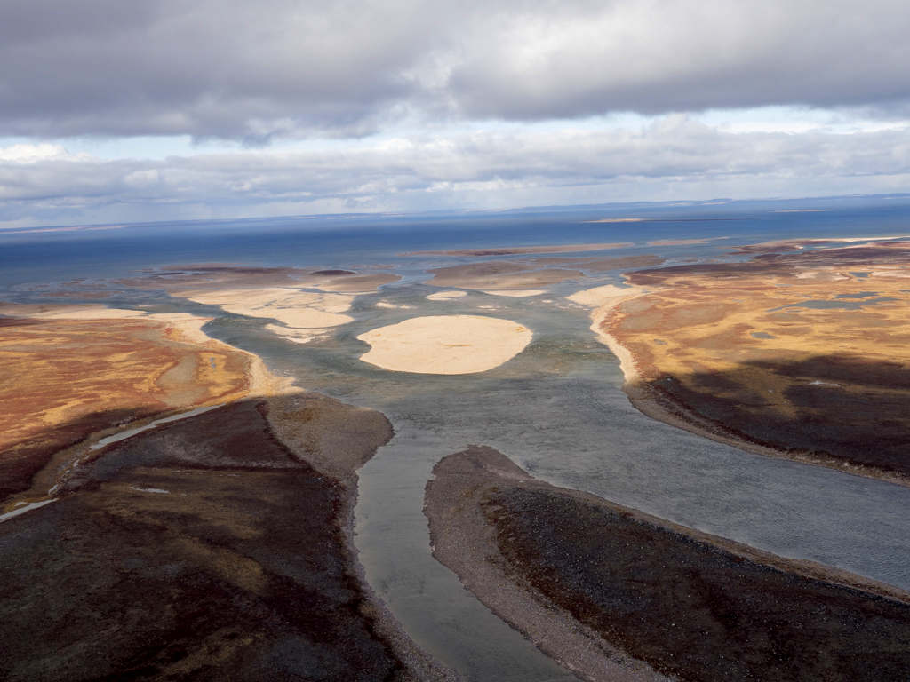
The Kazan River flows through a transitional area of boreal forest and treeless tundra, with the 615 km-long designated section flowing between the outlet of Ennadai Lake to Baker Lake, Nunavut.
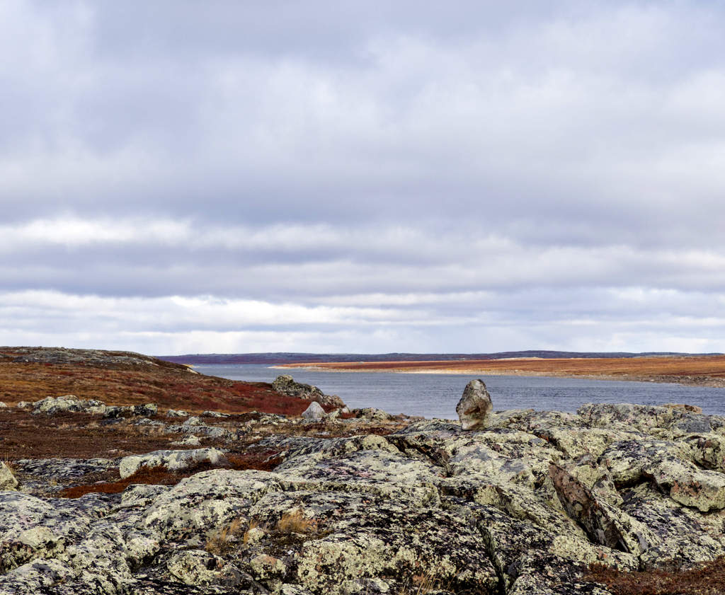
In the Kazan watershed, the forest, where it exists at all, is made up of sparse black spruce and tamarack, rarely more than a metre or two high. Rocky terrain with sandstone, granite, and volcanic rock can also be found in the region. Of particular interest are the tilted layers of blood-red sandstone formed by giant wind-blown dunes more than 1.8 billion years ago. These formations are visible on the east side of the river.
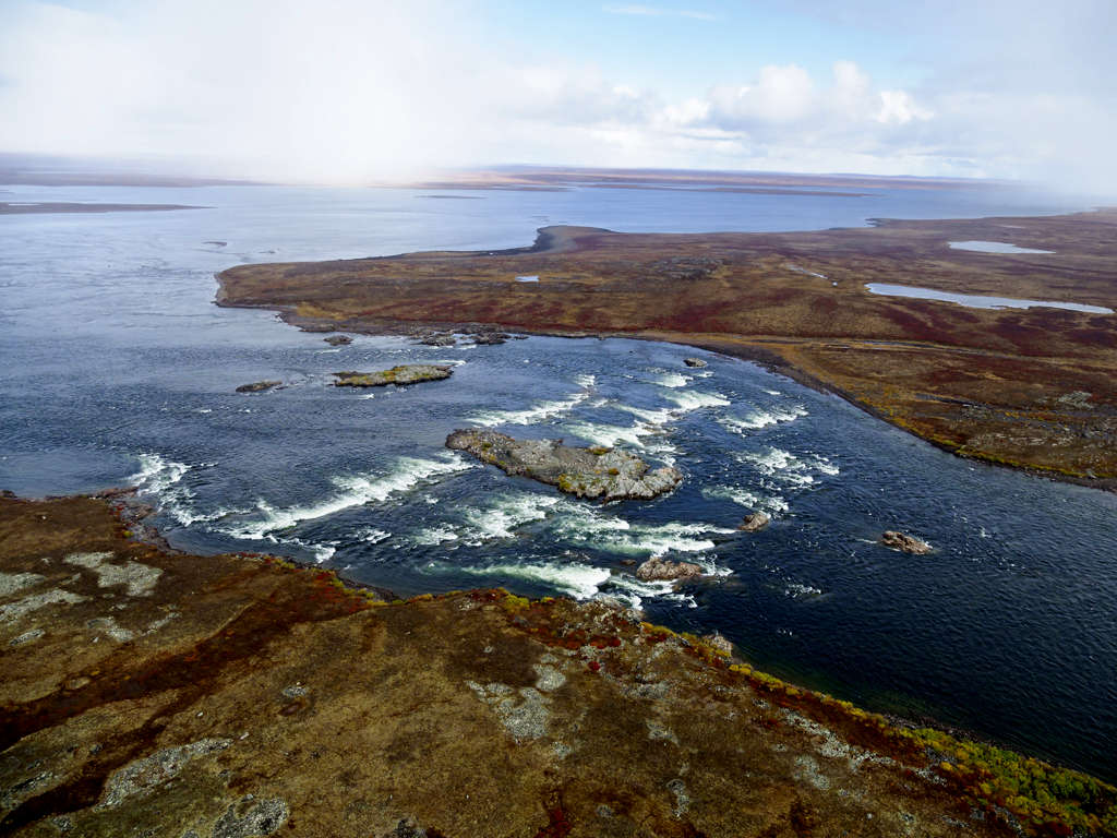
Some regions of the river have lush concentrations of vegetation surrounding swift-water narrows and imposing waterfalls. Notable features on the river include The Three Cascades, a series of five to seven metre-high waterfalls, as well as the beautiful Kazan Falls.
Cultural Heritage
Signs of the Caribou Inuit and the people who came before them are everywhere along the river, evocative of a time when they lived entirely off the land. Local Caribou Inuit from the communities of Baker Lake, Arviat and Whale Cove still travel by boat, going about their daily life hunting and fishing on the Kazan and its watershed area.
Their Dene and Inuit ancestors used the river during summers for more than 5,000 years, retreating to the tree line or the coast for the rest of the year. The Kazan was not formally mapped until J.B. Tyrrell, the first geologist on the river, canoed from its headwaters to Forde Lake in 1894.
Recreational Heritage
For six to eight weeks, from July to September, wilderness paddling enthusiasts can explore the river. There are many areas along the river suitable for camping, and virtually every site has evidence of past occupation by ancient and modern Inuit, such as hunting and camping grounds, lookouts and even gravesites. Extreme care should be taken to ensure these sites remain undisturbed. The Department of Culture and Heritage for Government of Nunavut encourages anyone who comes upon archaeological features, sites or artefacts to report the findings to the Territorial Chief Archaeologist.
Fishing for Arctic grayling and lake trout is excellent along the river. Caribou trails cross the tundra as the Kazan river runs through prime migration routes. The Inuit name for Caribou is Tuktu, named for the distinctive clicking of the animals’ ankle bones, Birdwatchers can also enjoy many species rarely seen in the south: Arctic terns, tundra swans, snowy owls and ptarmigans.
Fun Fact
New fact: Paddlers and canoeists traversing the Kazan River have been leaving notes for future groups at a cairn by Kazan Falls since the 1970’s. In 1992, the notes were removed for conservation, and a waterproof and bound copy of the notes was returned to the cairn. The original notes are on display in the Baker Lake Visitor Center.
River Managers
The Kazan River is managed jointly through a collaboration of several community partners, coordinated by Nunavut Parks and Special Places, a division of the Government of Nunavut.
Discover More
Designation
In July 1990, in recognition of its natural, cultural and recreational values, a 615 km section of the Kazan was designated a Canadian Heritage River.
The designation was based on the river’s unique boreal landscape and the role it plays in the migration route of the Qamanirjuaq caribou herd, the largest movement of land mammals in the world. The designation was also in recognition of the Caribou Inuit’s strong desire to have the river and their traditional life on the river commemorated.
Partners
- Kivalliq Inuit Association and Nunavut Tunngavik Incorporated
Resources
| title | type | file |
|---|---|---|
| Kazan River Ten-Year Review 1989 – 1999 Archived / archive en anglais seulement | Decadal Monitoring Reports | PDF of Kazan River Ten-Year Review 1989 – 1999 |
| Kazan | Harvaqtuuq River 20-Year Monitoring Report 2010 - 2020 Archived / archive en anglais seulement | Decadal Monitoring Reports | PDF of Kazan | Harvaqtuuq River 20-Year Monitoring Report 2010 - 2020 |
| Kazan | Harvaqtuuq 20-Year Monitoring Report 2020-2020_Inuktituk Archived / archive en anglais seulement | Decadal Monitoring Reports | PDF of Kazan | Harvaqtuuq 20-Year Monitoring Report 2020-2020_Inuktituk |
This page has been archived on the Web
Information identified as archived is provided for reference, research or recordkeeping purposes. It is not subject to the Government of Canada Web Standards and has not been altered or updated since it was archived. Please contact us to request a format other than those available.
Plaque Text
The Canadian Heritage River plaques offer a brief glimpse into why a river has been designated to the System. They are often located nearby one of its historically significant locations, and highlight some of the most important natural, cultural and recreational values of the river.
Kazan River Plaque Text
The Kazan River - The Kazan River valley is the home of the Caribou Inuit, the first people to live year-round on the treeless barrens. Here they have depended for generation on the vast caribou herds that migrate seasonally across the river. The Kazan was unknown to Europeans until 1770, when it was crossed by Samuel Hearne, and unmapped until 1894, when it was surveyed by the renowned Canadian scientist J.B. Tyrrell. Today, this wild river, cascading through the rugged Precambrian Shield, offers experienced canoeists spectacular whitewater and views of abundant wildlife, as well as insights into the Inuit way of life. For these outstanding features, the Kazan River has been proclaimed a Canadian Heritage River.